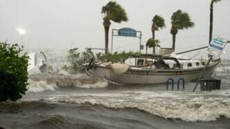
In the aftermath of the 2024 Atlantic hurricane season, questions have emerged about the differing impacts of storms Helene and Milton on the Tampa Bay area. Despite both storms rapidly intensifying before making landfall, only Helene brought a record-breaking storm surge to the region, while Milton did not.
The phenomenon of storm surge is driven by the forceful “push” of water rather than a “pull.” This was exemplified during Hurricanes Irma and Ian, where Tampa Bay experienced record-low water levels not because the water was “sucked” out but because the storms’ counterclockwise winds pushed the water away. Both of these hurricanes remained east of Tampa Bay, resulting in winds that directed water out of the bay area.
Helene took a different path, passing west of Tampa, which meant the storm’s counterclockwise winds pushed seawater directly into the bay, thereby creating an all-time high surge record. Such positioning was crucial in determining the surge’s impact. There was speculation that Milton might follow a similar route to Helene, as it initially seemed to head in the same direction. However, its trajectory shifted southward prior to landfall, sparing Tampa Bay from a similar surge event.
The geographical point of landfall plays a significant role in the effects experienced by coastal areas. Although Sarasota is just 50 miles south of Tampa and only a couple of hundred miles from where Helene landed, these distances were sufficient for Tampa Bay to avoid the increased water levels that a direct hit would have brought.
Understanding the factors influencing storm surge is critical for future preparedness. The paths of Helene and Milton demonstrate the importance of wind patterns and geographical factors in the impact of storms.
Source: NBCMiami


