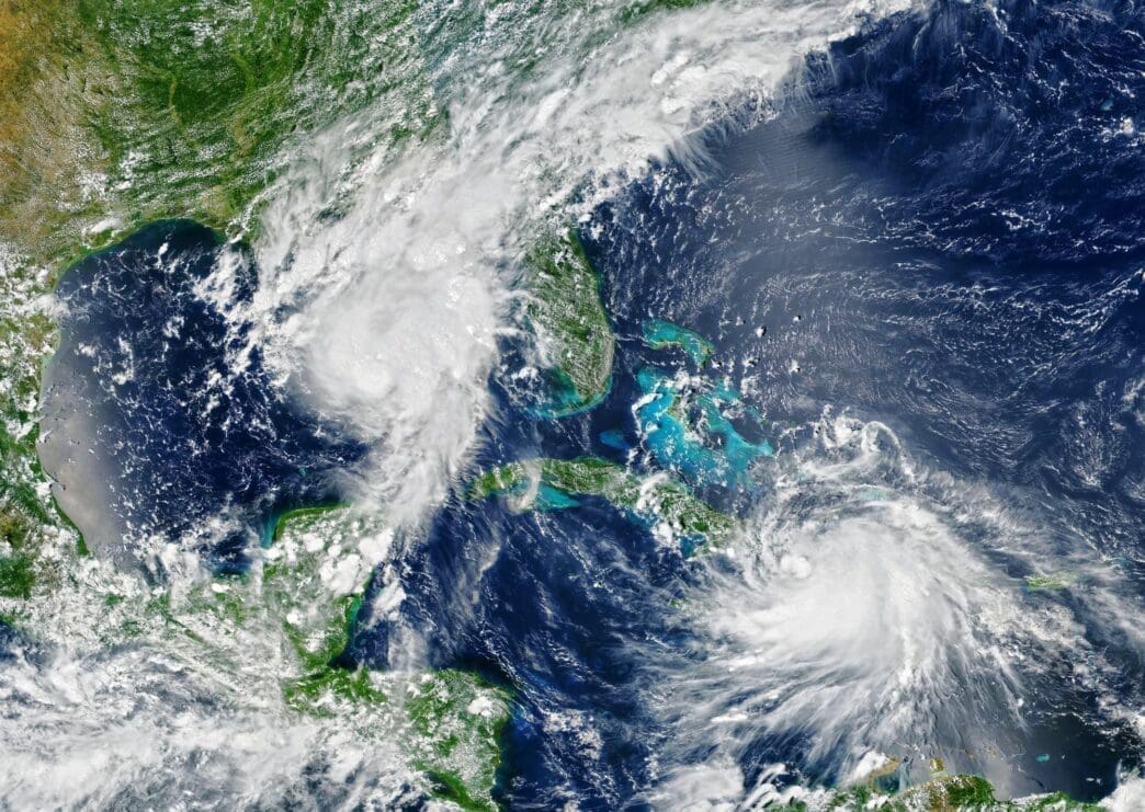
As Hurricane Milton intensified in the Gulf of Mexico and headed towards Florida on Wednesday, officials warned residents that the window for evacuation was closing. The outlook for those choosing to stay was dire.
The catastrophic storm continues to expand in size and intensity. It’s anticipated to make landfall later tonight, projecting it will strike between 10 p.m. and 2 a.m. As the hurricane approaches, communities along the coast are bracing for its impact, being acutely aware of the potential devastation it could unleash due to its powerful winds and massive storm surges.
Residents in the affected areas have been urged to finalize their preparations and evacuate if advised to do so by local authorities. The impending landfall during the nighttime hours adds an additional layer of concern, as reduced visibility could complicate any last-minute preparations or emergency responses. The situation remains fluid, and officials are closely monitoring the storm’s path and progression to provide timely updates and guidance to those in its trajectory.
Mandatory evacuations affected millions, with roads and bridges shutting down as the Category 4 hurricane threatened to unleash severe storm surges, destructive winds, and heavy rainfall. Deanne Criswell, the Federal Emergency Management Agency Administrator, noted on Wednesday morning, some may still evacuate safely, but for others, it might already be too late.
The storm posed a significant threat to the Tampa Bay region, a densely populated area of over 3.3 million people, which hasn’t been directly hit by a major hurricane in more than a century. As Hurricane Milton approached with increasing wind and rain, it loomed over communities still reeling from Hurricane Helene, which struck just two weeks earlier.
By early Wednesday, Tampa’s typically busy interstate was nearly deserted, and side streets saw minimal traffic. Drivers struggled to find gas stations that hadn’t closed or boarded up.
Forecasters from the National Hurricane Center cautioned that Milton would remain an extremely dangerous major hurricane upon reaching Florida’s coast.
When will Milton make landfall and how strong will it be?
Milton is anticipated to make landfall on Florida’s Gulf Coast late Wednesday. We are bracing and prepared for a major impact, stated Governor Ron DeSantis during a Wednesday briefing. By that morning, the storm was approximately 150 miles southwest of Tampa, with winds sustaining at 130 mph. It is expected to maintain hurricane strength as it traverses central Florida on Thursday, heading towards the Atlantic Ocean.
President Joe Biden, who delayed an overseas trip to monitor the situation from the White House, cautioned that Milton could be one of the worst storms in a century to hit Florida.
Why are scientists describing this as an unusual storm season?
Milton is part of what scientists are calling an exceptionally strange hurricane season. Despite predictions of an active Atlantic hurricane season, it was notably quiet from August 20 to September 23, which is typically peak season, according to Phil Klotzbach, a hurricane researcher at Colorado State University. However, between September 26 and October 6, five hurricanes emerged, setting a new record. On a single day in October, three hurricanes were recorded simultaneously, a first according to Klotzbach. In just under two days, Milton intensified from a tropical storm with 40 mph winds to a Category 5 hurricane.
While the hurricanes are causing widespread disruption, the notion of controlling such extreme weather events remains implausible. Scientists emphasize that climate change is intensifying storms like Helene and Milton by providing them with more energy.
What is the expected extent of the damage?
Florida’s Gulf Coast is particularly susceptible to storm surges. Hurricane Helene, which made landfall 180 miles north of Tampa, still resulted in drowning deaths in the area due to surges 5 to 8 feet above normal tide levels. With Milton, forecasts indicate a possible storm surge of 8 to 12 feet in Tampa Bay, and up to 13 feet from Anna Maria Island to Boca Grande.
In St. Petersburg, officials have alerted residents to prepare for prolonged power outages and potential sewage system shutdowns. Mayor Ken Welch warned that recovery wouldn’t be swift: We have a long road ahead of us. Milton is expected to pass through central Florida, potentially dropping up to 18 inches of rain as it moves toward the Atlantic Ocean, according to the hurricane center.
What if I have travel plans to Florida?
Airports, including Tampa International and nearby St. Pete-Clearwater International, have closed as the storm nears. Orlando, located approximately 84 miles inland, is also seeing shutdowns. Orlando International Airport, the nation’s seventh busiest and Florida’s most frequented, has ceased operations. Major theme parks such as Walt Disney World, Universal Orlando, and SeaWorld will also remain closed.


