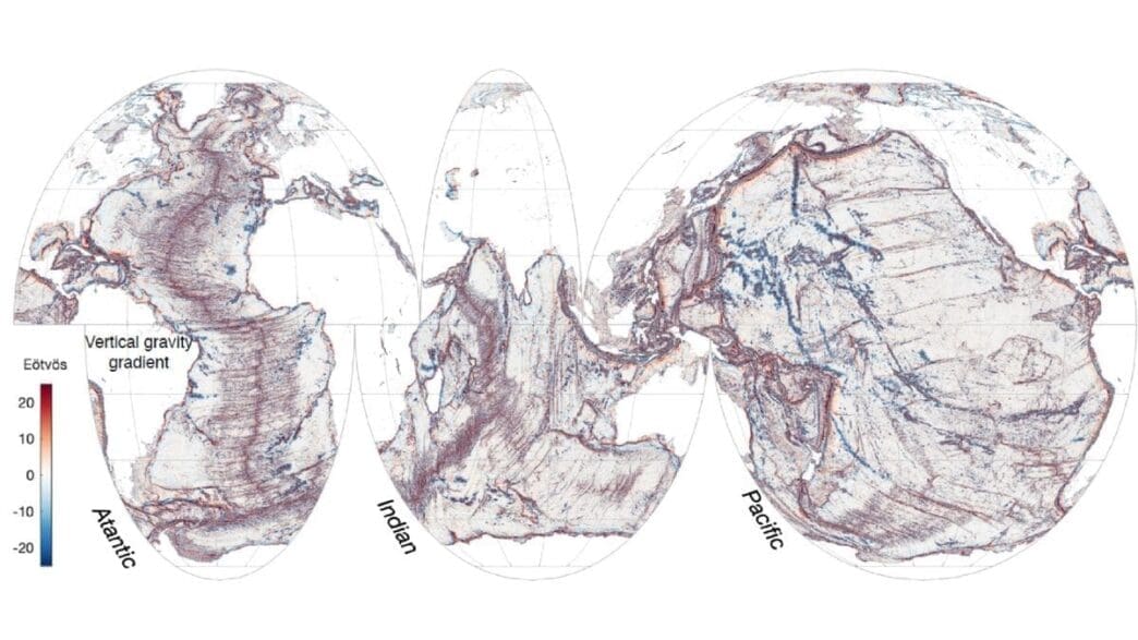
In a groundbreaking discovery, a new satellite has mapped Earth’s ocean floors with unprecedented detail, revealing features that have long been hidden beneath the waves. This achievement marks a significant advancement in our understanding of the planet’s underwater landscapes.
The recently launched Surface Water and Ocean Topography (SWOT) satellite, a collaboration between NASA and France’s Centre National D’Etudes Spatiales, has begun its mission by capturing more details of the sea floor in its first year than what was gathered in the last three decades by older satellites. The satellite’s capabilities allow researchers to examine the boundaries between continents, uncovering underwater hills and volcanoes unnoticed by previous technology.
According to study co-author Yao Yu from Scripps Institution of Oceanography, finding these features could catalyze new scientific developments, particularly in tectonic theories. This data may unveil new information regarding ocean currents, the transport of nutrients in seawater, and the geological history of Earth’s oceans. The SWOT satellite operates with a 5-mile resolution and covers a 21-day path encompassing most of the planet, providing a clearer view of the ocean floor than past missions.
To detect underwater structures, the SWOT satellite measures the height variations of the ocean surface. Surprisingly, the surface isn’t flat, as gravitational forces from structures like hills and volcanoes cause water to mound over these forms, creating detectable variations in surface height. These variations help identify what lies beneath.
Researchers concentrated on three types of underwater features: abyssal hills, seamounts, and continental margins. Abyssal hills, which are parallel ridges formed by tectonic plate movements, were mapped in detail, with some areas showing changes in ridge direction, suggesting historical shifts in tectonic interactions. Yao Yu expressed surprise at the number of abyssal hills detected in such a short span.
The team also focused on seamounts, or underwater volcanoes, which impact ocean currents and serve as biodiversity hotspots. While older satellites identified large seamounts, SWOT data revealed thousands of smaller seamounts previously unknown, measuring less than 3,300 feet in height. This new data allows for refined mapping of tectonic boundaries and ocean currents, particularly near coastal regions.
The studies of continental margins, where ocean currents and tides transport nutrients and sediments from land to sea, are of particular interest due to their influence on coastal biodiversity and ecology. The SWOT satellite data promises to enhance our understanding of these areas significantly.
In its planned three-year mission, the satellite will continue to collect data on ocean currents and map the ocean floor, contributing to the assessment of global freshwater resources.
The deployment of the SWOT satellite represents a major leap forward in marine science, promising to transform our understanding of underwater geological features and oceanic processes. This mission not only enriches scientific knowledge but also paves the way for future exploration and discovery.
Source: Space


