Following a weekend storm that delivered over four feet of snow in certain areas, the Great Lakes region is bracing for another wave of lake-effect snow.
Areas along the Great Lakes, particularly those known as snowbelts, experienced significant snowfall over the Thanksgiving weekend. Certain locations reported accumulations exceeding four feet. As the week progresses, weather patterns indicate a continuation of lake-effect snow until late Thursday or Friday.
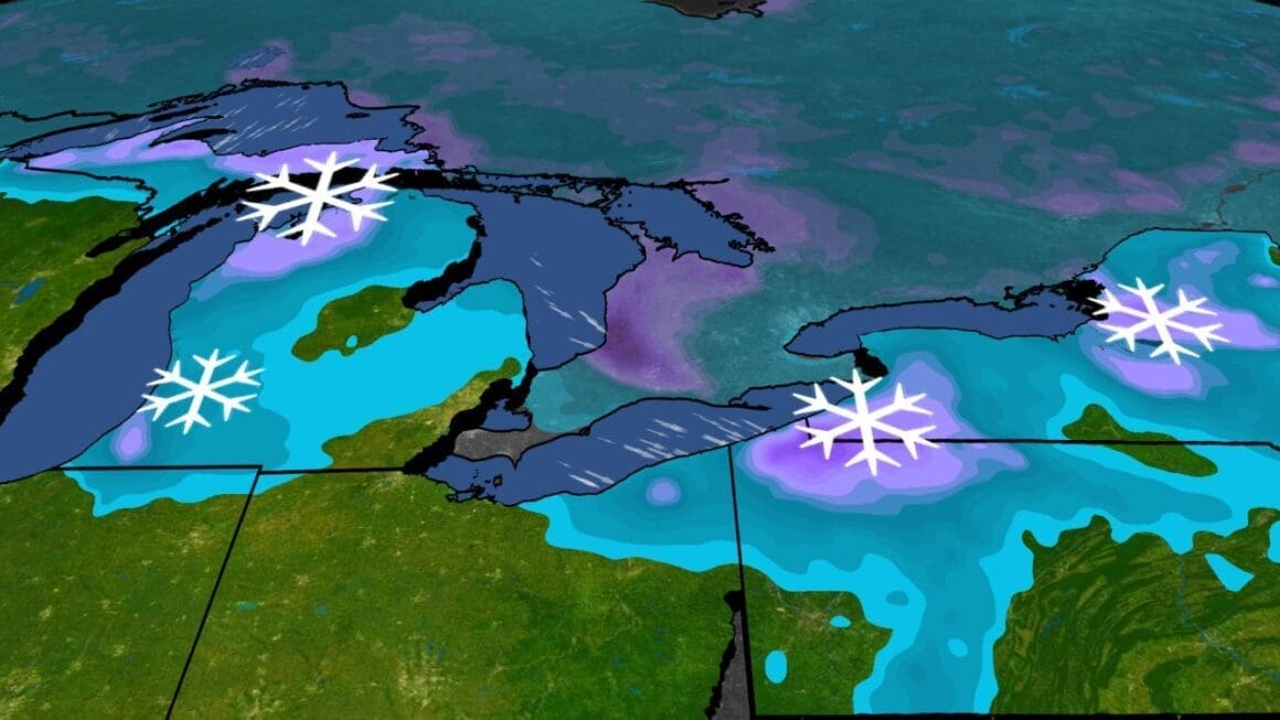
The persistent snow resulted from a combination of factors, including the recent powerful cold front meteorologists refer to as an ‘Alberta Clipper.’ This system is expected to travel south from Canada into the Midwest by Wednesday and advance into the Northeast by Thursday. The interaction of the cold front with the warm waters of the Great Lakes generates lake-effect snowbands. These bands are snowfall that occurs when cold air moves across the warmer lake waters, picking up moisture and depositing it in the form of snow on the leeward shores.
Weather warnings have been issued across parts of western Lower Michigan, northeastern Ohio, northwestern Pennsylvania, and southwestern New York. Such warnings highlight potential abrupt reductions in visibility and snow accumulation on roads. Residents and travelers in these areas should remain cautious as these conditions can impact transportation.
Though the upcoming snowfall is not expected to be as substantial as the previous weekend, certain regions might still receive up to a foot of snow, particularly in northwestern Pennsylvania through Friday. The heaviest snowfall last weekend was observed in communities such as Castorland, New York, Girard, Pennsylvania, and Saybrook, Ohio, among others. Erie, Pennsylvania faced its heaviest single-day snowfall on record, with 22.6 inches dropping on Black Friday alone.
Comparatively, Sault Ste. Marie in Michigan witnessed its latest ever first measurable snowfall of the season, accumulating 42 inches over the end of November, substantially more than its usual monthly total. With the Buffalo region also receiving up to three feet in parts, efforts were made over the weekend to clear large areas for events like the NFL game between the Buffalo Bills and the San Francisco 49ers.
As the Great Lakes region prepares for more snow, residents should brace themselves for potential disruptions. These weather patterns, while typical of the season, serve as a reminder of the powerful forces at play in this area each winter.
Source: Weather

